


CLAY 3650, Bartholomew County, Indiana
About
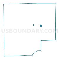
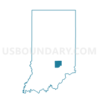
Outline

Summary
| Unique Area Identifier | 576350 |
| Name | CLAY 3650 |
| County | Bartholomew County |
| State | Indiana |
| Area (square miles) | 0.40 |
| Land Area (square miles) | 0.40 |
| Water Area (square miles) | 0.00 |
| % of Land Area | 100.00 |
| % of Water Area | 0.00 |
| Latitude of the Internal Point | 39.21534280 |
| Longtitude of the Internal Point | -85.80088100 |
Maps

Graphs
Select a template below for downloading or customizing gragh for CLAY 3650, Bartholomew County, Indiana


Neighbors
Neighoring Voting District (by Name) Neighboring Voting District on the Map
- CLAY 3500, Bartholomew County, IN
- CLAY 3600, Bartholomew County, IN
- COLUMBUS 1300, Bartholomew County, IN
- COLUMBUS 1400, Bartholomew County, IN
- COLUMBUS 3100, Bartholomew County, IN